
CustomWeather provides a wide range of weather services to companies in need of weather, wave, and current information for offshore. Whether your company is doing offshore survey work, setting up an offshore wind farm, involved with shipping, maintaining offshore assets, or just in need of general marine forecasts, CustomWeather can meet your needs.
Custom Site-Specific Marine Reports (PDF Delivery)
These site-specific reports provide a detailed marine and weather summary for the exact location(s) of interest. The reports are completely customized but usually contain site-specific text briefing, hurricane or cyclone updates, forecast charts for wind, wave, and weather information, along with line graphs outlining wind and wave trends for the next 5 days. The reports can be delivered via email or sent via fax.
Hurricane Tracking
CustomWeather provides detailed hurricane, cyclone, and typhoon tracking for all corners of the globe. All storms are tracked from their origin and plotted out for the next 5 days. Cones of uncertainty clearly identify possible track deviations of the storms. Satellite imagery is provided to complement the hurricane reports and tropical cyclone bulletins from local governments are provided.
Custom Marine Modeling
If general wind and wave models are not sufficient for your needs, CustomWeather can also run high-resolution marine model simulations over your particular domain. Typically, these high-resolution marine simulations are run at 1 km. resolution although much higher resolutions are possible. CustomWeather has PhD meteorologists on staff with expertise in running marine and weather models.
Custom Text Briefings
CustomWeather’s meteorologists can deliver site-specific text briefings for your exact location(s) covering anticipated synoptic conditions over the next few days. A general weather overview is included and significant weather is highlighted.
Ocean Currents Report
Features high-resolution location specific reports and forecasts for ocean currents at varying depths for depths down to 3,000 meters. Variables include ocean current direction, speed, water temperature, and salinity. The sea height anomaly is also reported for the surface. Daily reports and 14 day forecasting is available. The reports are updated on a daily basis.
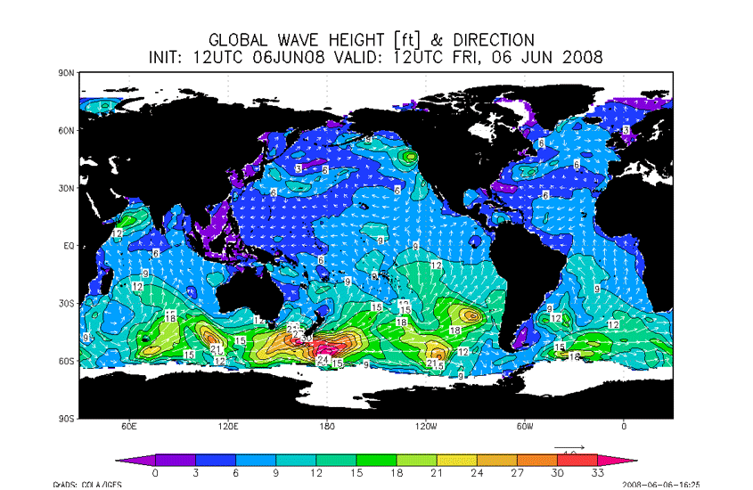
Ocean Mapping
CustomWeather can provide detailed maps or map overlays of winds, waves, sea surface temperatures, and ocean currents for your area. Dozens of weather variables, synoptic features, and tropical systems can also be mapped. CustomWeather has also developed peril maps to highlight areas that may experience dangerous weather conditions.

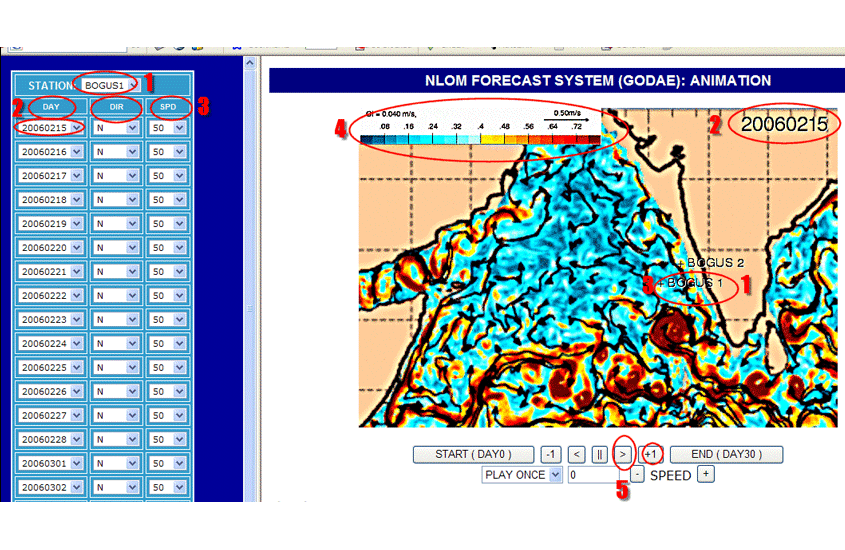
Custom Marine Web Portal
Any of the products mentioned above can be accessed via a customized, secure web portal for your exact offshore location(s). The web portal includes dozens of marine maps and charts in a user-friendly viewing environment.
Need a Custom Solution?