
A suite of tools designed to support and enhance the implementation of CustomWeather’s products.
CustomWeather API
- API available in XML or JSON
- Clients can request data via HTTPS for secure data encryption
- A proven forecast model with a high degree of accuracy
- Hyperlocal weather data for over 80,000 locations
- Ability to refine forecasts down to 100 meter resolution worldwide
- Engaging satellite, radar and future radar animations accessed via maptile server
- Visually engaging maps and graphics
- High degree of scalability
- Geolookup
- Over 85 different languages
Cloud Weather Services™
- Easy access via API, available in both XML and JSON
- Enables point access in real-time via web service to large gridded data sets, without requiring the download of complete government model data sets
- Ability to create real-time comparison between models, and create plugins for value-add variables based on raw data from the models
- value-add variables include a hail index and even wind direction in degrees, which is normally reported as just U and V vectors in government models
- easy access to many obscure model variables which are critical to specific industries. Examples are short-wave radiation for the solar industry, and soil moisture at various depths for agriculture

Locations
All forecast locations geocoded to provide:
- latitude
- longitude
- time zone
- state, province, and country

Data Feeds
Data feeds available:
- CSV
- XML
- JSON
- delivery via HTTPS, Amazon S3, or SFTP/FTP
- can import geospatial data and overlay on maps
Searching
Easy and accurate searching:
- US zip code
- regional mapping databases
- postal codes available for Canada, UK and many other countries.

Languages
Weather data is available in over 80 languages including:
English • French • Spanish • German • Dutch • Italian • Portuguese • Chinese • Japanese

Map Tile Server
- On-demand, real-time weather map tiles
- meteorological layers derived from dozens of weather models
- utilizes quadkey structure compatible with map tile systems including Microsoft BING or Google Maps
- real-time information such as radar, satellite, estimated temperatures, and weather warnings
- tropical storm tracking

Open GIS-Based Map Server
- map layers in real-time
- delivered via http interface
- set your size and area
- worldwide coverage
- various formats and projections
- use our base map or your own

Custom Web Templates
A web template can be designed around virtually any layout specified by a client.
Sample Code Available
Sample code can be supplied using XML query.
Icons
Multiple icon sets and styles suitable for print, web and wireless display.
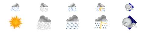
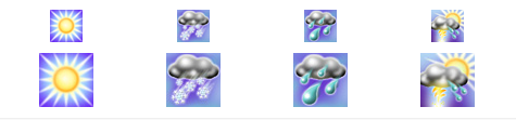
Icon Set 1 (Realistic Style), Large and Small
The examples shown are part of a much larger set of icons
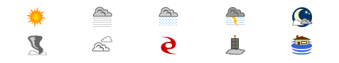
Icon Set 2 (Vector Style)
The examples shown are part of a much larger set of icons

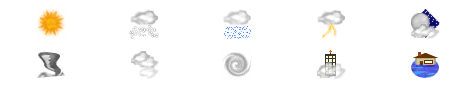
Icon Set 3 (Button Style), Large and Small
The examples shown are part of a much larger set of icons
Icon Set 4 (Animated)
The examples shown are part of a much larger set of icons
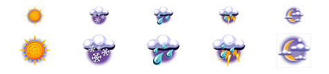
Icon Set 5 (MyForecast), Large and Small
The examples shown are part of a much larger set of icons
Icon Set 6, Large and Small
The examples shown are part of a much larger set of icons
Need a Custom Solution?