
CustomWeather is a one-stop weather data warehouse for companies involved in wind, solar, and hydro-power industries.

Support for Renewable Energy Facilities
As the world moves away from its dependence on oil, weather itself will dictate much of the world’s available energy supply.
CustomWeather supports businesses that establish and operate wind and solar farms.
- Historical weather data to enable planning, optimum placement and anticipated capacity.
- Critical forecast expertise for on-going operations.
Solar Battery Optimization Bundle
Designed to support and serve utilities, module makers and integrators running XML systems, this bundle offers a cost-effective solution for operators the daily planning and real-time data they need to optimize performance.
ERA5 baselines, GFS next-day Global Horizontal Irradiance (GHI) data, and live estimated temperature and humidity. All data is global and available via API for reliable access and easy integration.
ERA5
ECMWF Reanalysis Version 5: A key dataset for machine learning applications, the ERA5 is also critical to the study of specific historical events, low-frequency variability and extremes in climate studies.
Estimator Grids
Developed by CustomWeather exclusively, our Estimator Grids provide a snapshot every 10 minutes at 10km resolution of the estimated conditions for any point on Earth, including essentials such as current temperature, humidity, dew point, wind speed/direction, and barometric pressure.
Solar Radiation Forecast
Features a 15 day forecast delivers the measure of solar radiation energy received on a given surface area from incoming short-wave solar radiation or ‘insolation’. Deliverable variables include the average irradiance flux in watts per square meter (W/m2) and total short-wave downward solar radiation. Updated 4 times per day.

Historical Weather Information
- 30+ years of hourly climate data for tens of thousands of weather stations around the world
- Access to multiple public and private networks of weather stations
- Gridded re-analysis data sets going back 40+ years that can be down-scaled to finer resolutions

Extremely High Resolution Weather Forecasts
- WRF model forecasts that can be customized and fine-tuned around on-site weather stations.
- Access to PhD meteorologists with modeling expertise
- Ability to capture local terrain effects that publicly available data simply misses

Wind Expertise
- Ability to model wind speeds at ground-level and tower height
- Diurnal wind cycles captured graphically or in data files
- Partnered with companies involved in the setup of remote, on-site weather stations (via satellite or cellular)
- Experience with offshore weather forecasting for marine wind farms

Solar Radiation Data Available
- Forecasted hourly incoming solar radiation values available for any point on the globe for the next 7 days
- Sunshine hour information
- Short-wave radiation maps available
- Flash charts with daily distribution

Detailed Hydrological Information
- Doppler-radar and satellite (TRMM) estimated precipitation totals available
- Real-time current conditions and river gauge information
- High resolution precipitation maps available

Industry-leading GIS Solutions
- All of CustomWeather’s content is available in GIS formats in addition to point data
- Shape files, OpenGIS-based map layers, NetCDF files
- Ability to plot hundreds of different weather variables for time frames from a few hours to a few weeks
For more information about our GIS solutions, click here.
Sample Maps and Reports
CustomWeather’s robust mapping and reporting capabilities can be customized to provide targeted information in a visually engaging format. For a comprehensive overview of our mapping and reporting capabilities, contact us.
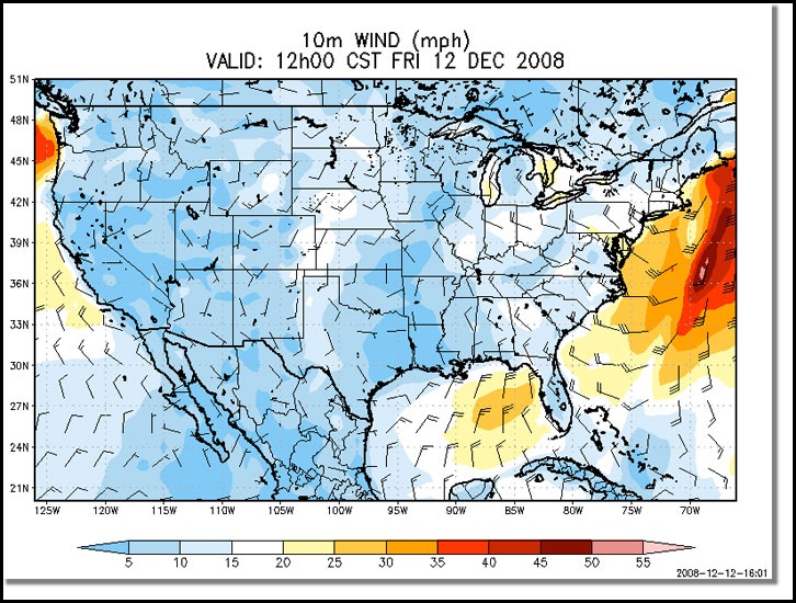
US Wind Forecast Map
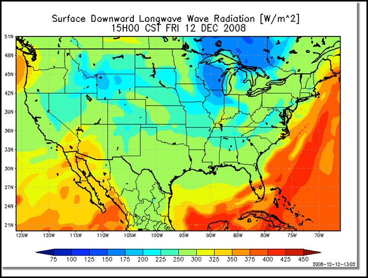
Incoming Long Wave Radiation Map
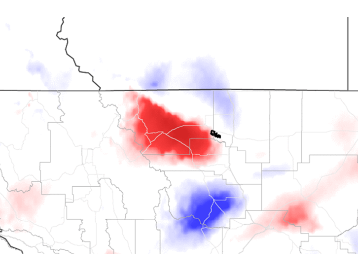
Montana Wind Ramp Map
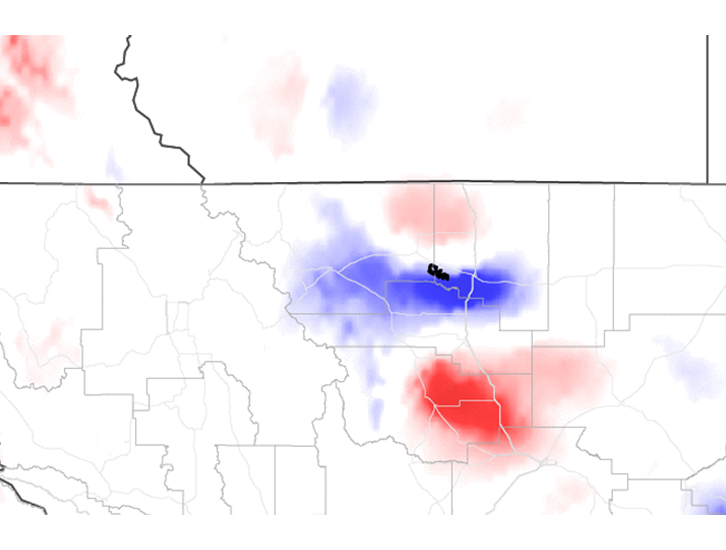
Glacier Ramp Up/Down Map
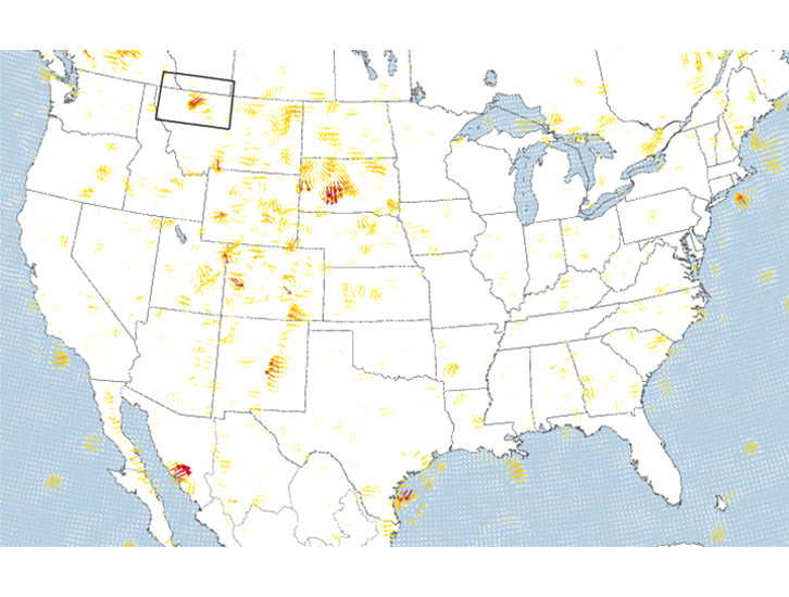
US Wind Ramp Map
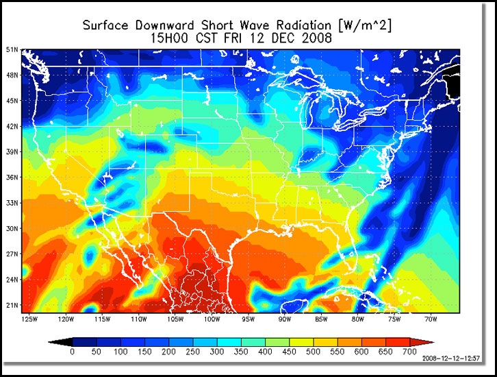
Short Wave Radiation Map
Need a Custom Solution?