Weather products to support insurers and insurance traders across the life cycle of the policy and across the enterprise.

CWRisk™
Unmatched flexibility streamlines the ingestion of relevant data and mapping into a wide range of applications and allows for global, regional, and street level intelligence.
- Comprehensive alerts
- Forecasts
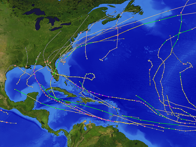
- Real-time tracking
- Post event analysis
Customization can include the display, monitoring, or interaction of specific variables or derivatives of these variables, along with more advanced high-resolution modeling of regions, variables, or events.
With CustomWeather, your business benefits:
- Minimize long-term and short-term risk
- Limit potential impact of severe weather events
- Supporting data for asset monitoring, policy holder notification, real-time awareness and risk assessment
- Preparedness: Better post-event response and assistance, crew dispatch, supply chain management
- Accurate weather data to support customer service and claim management and verification
Real-Time Monitoring and Forecast Path
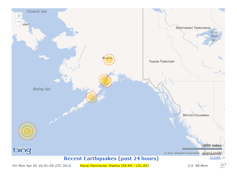
- Earthquake reports
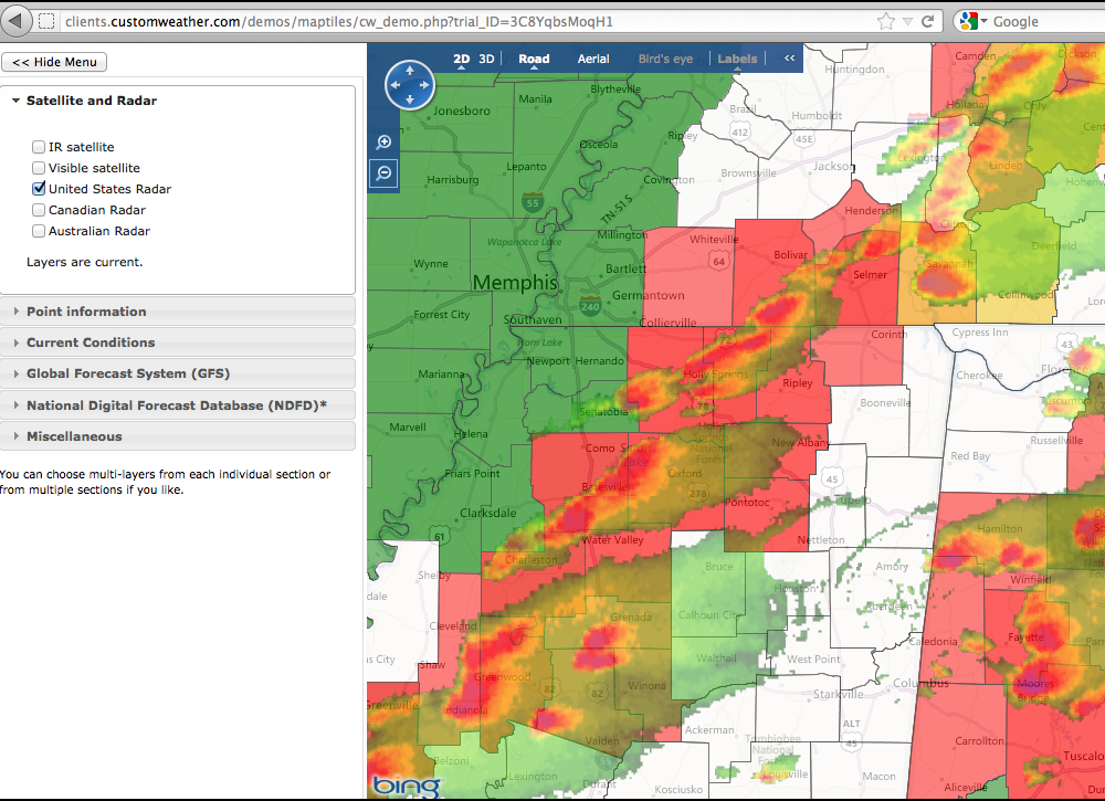
- Government-issued alerts, watches and warnings
- Tropical storm tracking and river levels
- Current condition monitoring and alerts
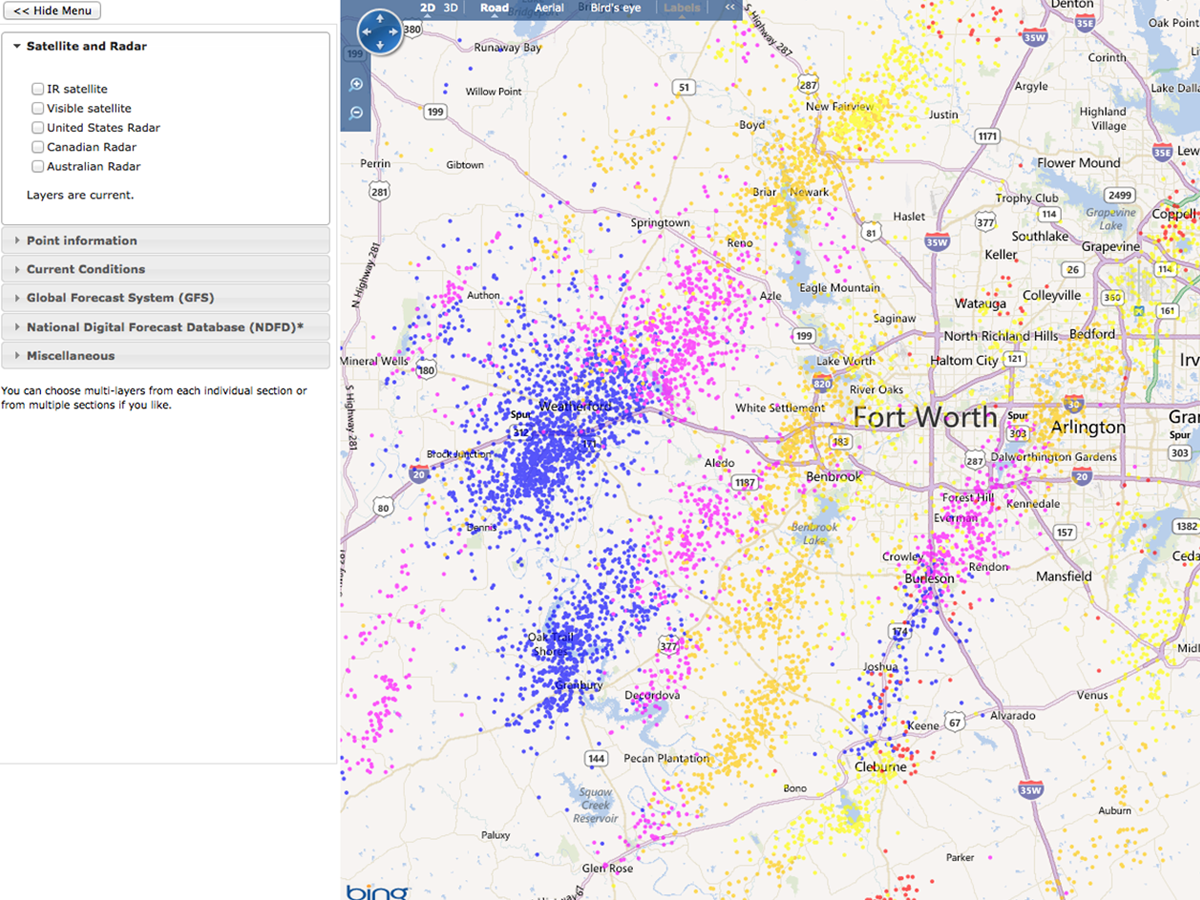
- Severe weather Doppler radar echoes
- Individual storm cell tracking and forecast path
- Doppler-indicated tornado touch-down and forecast path
- Hail events and forecast path
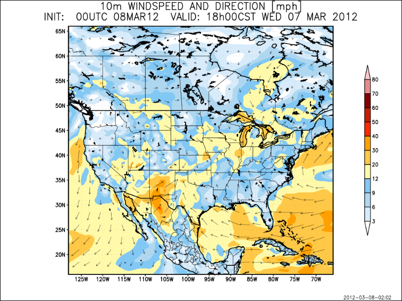
- Wind speed and gust information
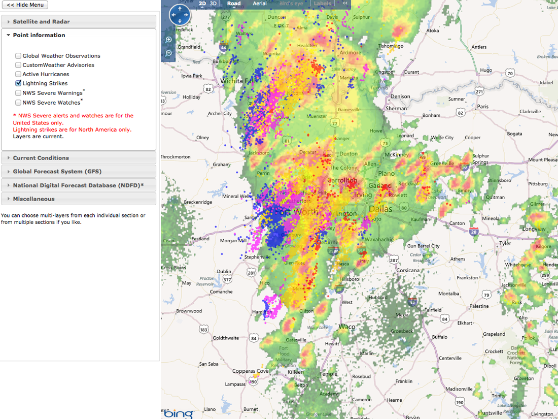
- Lightning strikes
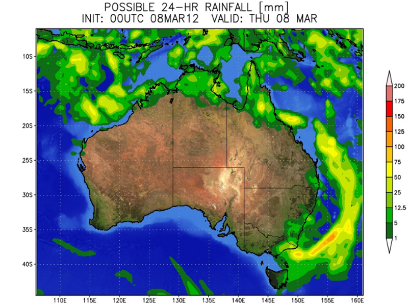
- Forecast rainfall totals for next hour/6 hours/24 hours
Post-Event Analysis
- NWS post-storm reports and updates
- Storm spotter reports
- Past 1 hour/6 hour/24 hour analysis
- Archive of Doppler radar, storm cell, tornado, hail, wind and precipitation data
- Full previous day summary from the Storm Prediction Center
- Post-event analysis by CustomWeather meteorologist
Data Delivery
Data and image transfer (web services, FTP, open socket connection) • Web mapping service
Tile mapping service • Geo-spatial data web query • Hosted portals • Public web display
Mobile and email alerts • GIS file delivery (click here for more GIS Information)
Sample Maps and Reports
CustomWeather’s robust mapping and reporting capabilities can be customized to provide targeted information in a visually engaging format. For a comprehensive overview of our mapping and reporting capabilities, contact us.
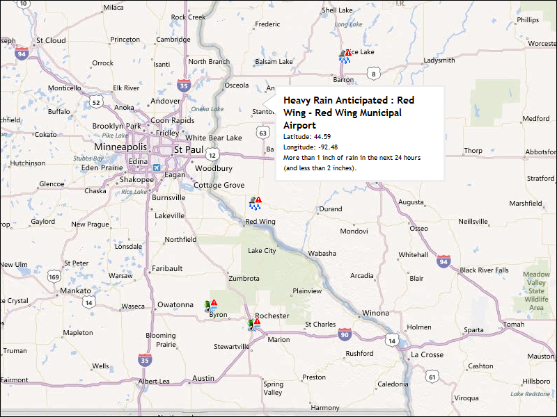
Global Weather Advisories
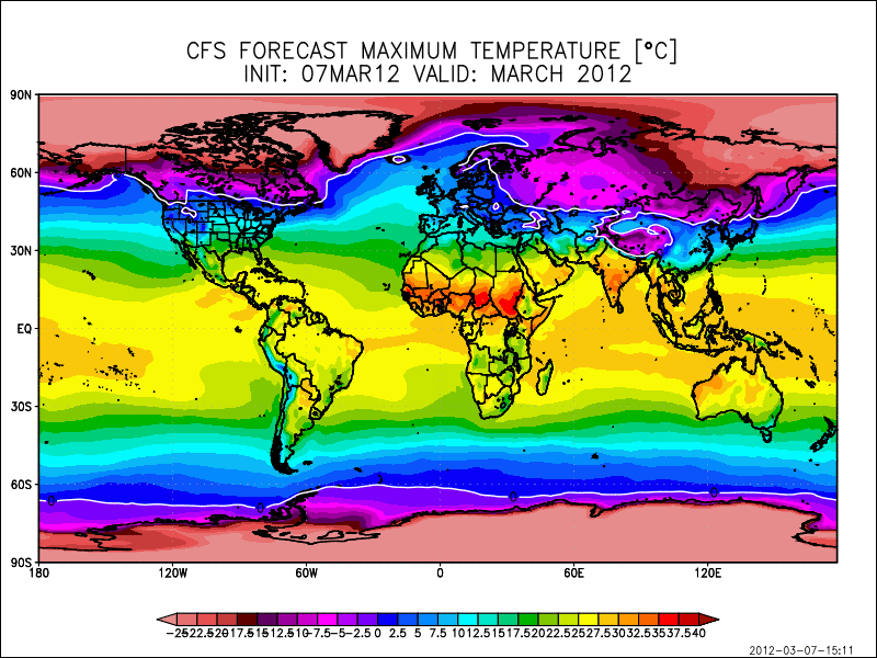
Max Temperature
Forecasted Wind Speed and Direction
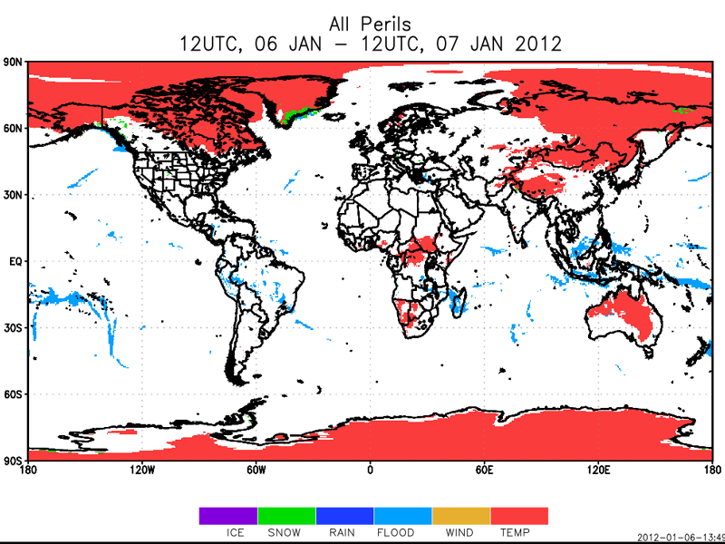
Peril Map
Recent Earthquakes
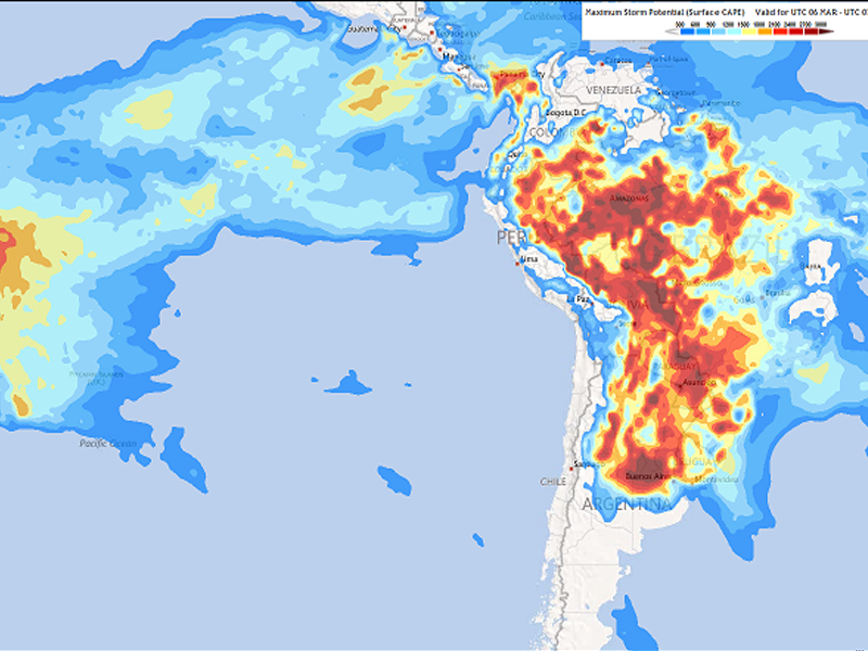
Storm Potential Forecast Map (CAPE)
Need a Custom Solution?

